Weather Warnings Archive: Monday 22 Jan 2024 22:22 GMT - UK


00:00-06:00

06:00-12:00

12:00-18:00

18:00-24:00


Severe Weather Warnings: Wind
issued by the Metoffice at
22:22, 22.01.2024
valid from
12:00, 21.01.2024
until
12:00, 22.01.2024
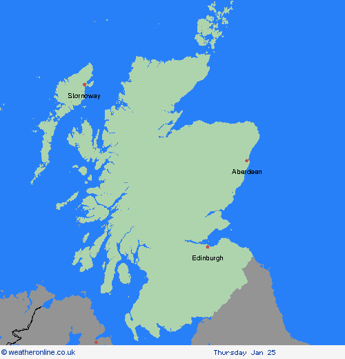
Region: Grampian
Strong winds associated with Storm Isha are expected to develop widely across the UK. Strong winds will arrive into Northern Ireland and western parts of England and Wales during Sunday afternoon, before becoming more widespread through the evening and overnight. Winds will gradually ease from the west during Monday morning. West or southwesterly winds are likely to widely gust 50 to 60 mph inland with a few locations, mainly exposed coastal stretches, reaching 70 to 80 mph. What should I do? Prepare to protect your property and people from injury. Check for loose items outside your home and plan how you could secure them. Items include; bins, garden furniture, trampolines, tents, sheds and fences. Give yourself the best chance of avoiding delays by checking road conditions if driving, or bus and train timetables, amending your travel plans if necessary. People cope better with power cuts when they have prepared for them in advance. It’s easy to do; consider gathering torches and batteries, a mobile phone power pack and other essential items. If you are on the coast, particularly in this instance on west- and south-facing coasts, stay safe during this stormy weather by being aware of large waves. Even from the shore large breaking waves can sweep you off your feet and out to sea. Take care if walking near cliffs; know your route and keep dogs on a lead. In an emergency, call 999 and ask for the Coastguard. Be prepared for weather warnings to change quickly. When a weather warning is issued, the Met Office recommends staying up to date with the weather forecast in your area.
Chief ForecasterStrong winds associated with Storm Isha are likely to bring some disruption to travel and utilities across the UK on Sunday and Monday.
The public is advised to take extra care, further information and advice can be found here: http://www.metoffice.gov.uk/weather/uk/links.html
Severe Weather Warnings: Ice
issued by the Metoffice at
22:22, 22.01.2024
valid from
23:00, 22.01.2024
until
09:00, 23.01.2024
Region: Grampian
As showers continue to ease, clearing skies will allow ground temperatures to fall below freezing, and with wet surfaces, icy stretches will readily form on untreated roads and pavements. What should I do? Keep yourself and your family safe when it is icy. Plan to leave the house at least five minutes earlier than normal. Not needing to rush, reduces your risk of accidents, slips, and falls. If you need to make a journey on foot, try to use pavements along main roads which are likely to be less slippery. Similarly, if cycling, try and stick to main roads which are more likely to have been treated. Give yourself the best chance of avoiding delays by checking road conditions if driving, or bus and train timetables, amending your travel plans if necessary. Be prepared for weather warnings to change: when a weather warning is issued, the Met Office recommends staying up to date with the weather forecast in your area.
Chief ForecasterIcy stretches bringing some difficult driving conditions
The public is advised to take extra care, further information and advice can be found here: http://www.metoffice.gov.uk/weather/uk/links.html
Severe Weather Warnings: Wind
issued by the Metoffice at
22:22, 22.01.2024
valid from
01:00, 22.01.2024
until
05:00, 22.01.2024
Region: Grampian
A short spell of extremely strong westerly winds will affect a small area of northern Scotland early on Monday. Gusts of 90 to 100 mph are likely for a brief time, bringing a risk of damage, disruption and a danger to life. Winds will steadily moderate through Monday morning but will remain strong. What should I do? Keep yourself and others safe. Avoid travelling by road during potentially dangerous conditions. It is not safe to drive in these conditions. Don't risk injury to others or damage to your property. If you can do so safely, check for loose items outside your home and secure them. Items include; bins, garden furniture, trampolines, tents, sheds and fences. Being outside in high winds makes you vulnerable to injury. Stay indoors if you can. If you live or work on the coast, beware of large waves, even from the shore large breaking waves can sweep you off your feet and out to sea. In an emergency, call 999 and ask for the Coastguard. Stay up to date with the weather forecast for your area and follow advice from emergency services and local authorities.
Chief ForecasterA short spell of extremely strong winds leading to danger to life, structural damage and disruption.
The public is advised to take extra care, further information and advice can be found here: http://www.metoffice.gov.uk/weather/uk/links.html
Severe Weather Warnings: Wind
issued by the Metoffice at
22:22, 22.01.2024
valid from
18:00, 21.01.2024
until
06:00, 22.01.2024
Region: Grampian
After a generally windy day on Sunday, winds are likely to increase further during the evening and overnight, this increase reaching Northern Ireland first. Winds are likely to gust to 60 to 70 mph quite widely in inland areas, and 70 to 80 mph around coasts. However there is the possibility of a narrower swathe of even stronger winds crossing parts of the warning area, with gusts of 70 to 80 mph possible inland and perhaps peaking around 90 mph in exposed coastal and hilly areas - this is perhaps more likely across parts of Scotland. Winds will subside during the early hours across Northern Ireland, and across the rest of the area on Monday morning, although staying windy and gusty. What should I do? Prepare to protect your property and people from injury. Check for loose items outside your home and plan how you could secure them. Items include; bins, garden furniture, trampolines, tents, sheds and fences. Windy weather can cause delays and make travel conditions dangerous. Follow these few simple steps to prepare before journeys. Check bus and train timetables, amending your travel plans if necessary. If driving, check road conditions and ensure you have essentials in your car (warm clothing, food, water, a blanket, a torch, an in-car phone charger). People cope better with power cuts when they have prepared for them in advance. It’s easy to do; consider gathering torches and batteries, a mobile phone power pack and other essential items. If you are on the coast, stay safe during stormy weather by being aware of large waves, even from the shore large breaking waves can sweep you off your feet and out to sea. Take care if walking near cliffs; know your route and keep dogs on a lead. In an emergency, call 999 and ask for the Coastguard. Be prepared for weather warnings to change quickly: when a weather warning is issued, the Met Office recommends staying up to date with the weather forecast in your area.
Chief ForecasterA spell of very strong, perhaps damaging, winds associated with Storm Isha is likely to bring disruption to transport and infrastructure.
The public is advised to take extra care, further information and advice can be found here: http://www.metoffice.gov.uk/weather/uk/links.html


22.01.2024