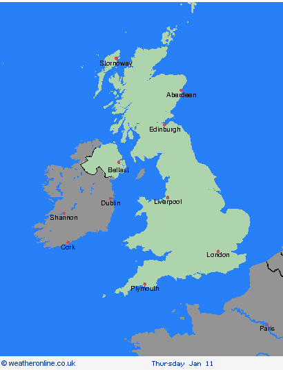
Weather Warnings Archive: Monday 08 Jan 2024 10:04 GMT - UK


00:00-06:00

06:00-12:00

12:00-18:00

18:00-24:00


Severe Weather Warnings: Ice
issued by the Metoffice at
10:04, 08.01.2024
valid from
05:00, 08.01.2024
until
10:00, 08.01.2024
Region: Northern Ireland
Showers moving inland across south-eastern parts of Northern Ireland will lead to rain falling onto sub-zero surfaces and development of ice on some untreated surfaces. What should I do? Keep yourself and your family safe when it is icy. Plan to leave the house at least five minutes earlier than normal. Not needing to rush, reduces your risk of accidents, slips, and falls. If you need to make a journey on foot or by bike, try to use pavements along main roads which are likely to be less slippery. Give yourself the best chance of avoiding delays by checking road conditions if driving, or bus and train timetables, amending your travel plans if necessary. Be prepared for weather warnings to change: when a weather warning is issued, the Met Office recommends staying up to date with the weather forecast in your area.
Chief ForecasterIce may lead to some difficult travelling conditions at first this morning.
The public is advised to take extra care, further information and advice can be found here: http://www.metoffice.gov.uk/weather/uk/links.html
Severe Weather Warnings: Ice
issued by the Metoffice at
10:04, 08.01.2024
valid from
15:00, 08.01.2024
until
03:00, 09.01.2024
Region: Wales
Parts of southern Britain are likely to see some snow showers during Monday afternoon and the first part of the night. Most places will see little or no lying snow, but 1-2 cm may settle in one or two places, mostly over high ground. In addition, some icy surfaces are possible for a time. However, the chance this reduces by dawn on Tuesday as snow showers clear to the west and surfaces dry out.
Chief ForecasterIce and small amounts of snow could lead to slippery surfaces in a few places.
The public is advised to take extra care, further information and advice can be found here: http://www.metoffice.gov.uk/weather/uk/links.html
Severe Weather Warnings: Ice
issued by the Metoffice at
10:04, 08.01.2024
valid from
15:00, 08.01.2024
until
03:00, 09.01.2024
Region: West Midlands
Parts of southern Britain are likely to see some snow showers during Monday afternoon and the first part of the night. Most places will see little or no lying snow, but 1-2 cm may settle in one or two places, mostly over high ground. In addition, some icy surfaces are possible for a time. However, the chance this reduces by dawn on Tuesday as snow showers clear to the west and surfaces dry out.
Chief ForecasterIce and small amounts of snow could lead to slippery surfaces in a few places.
The public is advised to take extra care, further information and advice can be found here: http://www.metoffice.gov.uk/weather/uk/links.html
Severe Weather Warnings: Ice
issued by the Metoffice at
10:04, 08.01.2024
valid from
15:00, 08.01.2024
until
03:00, 09.01.2024
Region: East of England
Parts of southern Britain are likely to see some snow showers during Monday afternoon and the first part of the night. Most places will see little or no lying snow, but 1-2 cm may settle in one or two places, mostly over high ground. In addition, some icy surfaces are possible for a time. However, the chance this reduces by dawn on Tuesday as snow showers clear to the west and surfaces dry out.
Chief ForecasterIce and small amounts of snow could lead to slippery surfaces in a few places.
The public is advised to take extra care, further information and advice can be found here: http://www.metoffice.gov.uk/weather/uk/links.html
Severe Weather Warnings: Ice
issued by the Metoffice at
10:04, 08.01.2024
valid from
15:00, 08.01.2024
until
03:00, 09.01.2024
Region: South West England
Parts of southern Britain are likely to see some snow showers during Monday afternoon and the first part of the night. Most places will see little or no lying snow, but 1-2 cm may settle in one or two places, mostly over high ground. In addition, some icy surfaces are possible for a time. However, the chance this reduces by dawn on Tuesday as snow showers clear to the west and surfaces dry out.
Chief ForecasterIce and small amounts of snow could lead to slippery surfaces in a few places.
The public is advised to take extra care, further information and advice can be found here: http://www.metoffice.gov.uk/weather/uk/links.html
Severe Weather Warnings: Ice
issued by the Metoffice at
10:04, 08.01.2024
valid from
04:00, 08.01.2024
until
10:00, 08.01.2024
Region: London & South East England
A mix of sleet and snow showers will move in from the east later on Sunday night along with temperatures near zero. Given these wintry showers, and also wet surfaces after recent wet weather, some icy patches are likely on untreated surfaces. Additionally a few of the snow showers could turn quite heavy; these probably only affecting a narrow zone but a few places could see 1-3 cm, mainly over the north Downs and on grassy surfaces. What should I do? Keep yourself and your family safe when it is icy, or small amounts of snow have fallen. Plan to leave the house at least five minutes earlier than normal. Not needing to rush, reduces your risk of accidents, slips, and falls. If you need to make a journey on foot, try to use pavements alongside main roads which are likely to be less slippery. Similarly, if cycling, try to stick to main roads, which are more likely to have been treated. Be prepared for weather warnings to change; the Met Office recommends staying up to date with the weather forecast in your area.
Chief ForecasterIcy patches and wintry showers affecting some areas on Monday morning, leading to potentially slower journeys.
The public is advised to take extra care, further information and advice can be found here: http://www.metoffice.gov.uk/weather/uk/links.html
Severe Weather Warnings: Ice
issued by the Metoffice at
10:04, 08.01.2024
valid from
15:00, 08.01.2024
until
03:00, 09.01.2024
Region: London & South East England
Parts of southern Britain are likely to see some snow showers during Monday afternoon and the first part of the night. Most places will see little or no lying snow, but 1-2 cm may settle in one or two places, mostly over high ground. In addition, some icy surfaces are possible for a time. However, the chance this reduces by dawn on Tuesday as snow showers clear to the west and surfaces dry out.
Chief ForecasterIce and small amounts of snow could lead to slippery surfaces in a few places.
The public is advised to take extra care, further information and advice can be found here: http://www.metoffice.gov.uk/weather/uk/links.html

08.01.2024