Weather Warnings Archive: Saturday 20 Jan 2024 19:28 GMT - UK


00:00-06:00

06:00-12:00
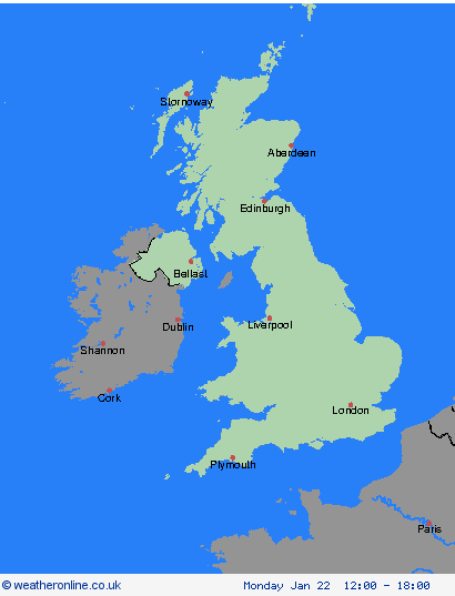
12:00-18:00

18:00-24:00


Severe Weather Warnings: Wind
issued by the Metoffice at
19:28, 20.01.2024
valid from
21:00, 21.01.2024
until
09:00, 22.01.2024
Region: Orkney & Shetland
After a generally windy day on Sunday, there is a chance that a spell of very strong winds could track east-northeast across much of Scotland Sunday night, clearing into the North Sea Monday morning. Should this happen, then westerly winds could bring gusts of 65-75 mph, even inland, whilst gusts of 80-85 mph could occur very locally, most likely over parts of west and northern Scotland. What should I do? Prepare to protect your property and people from injury. Check for loose items outside your home and plan how you could secure them. Items include; bins, garden furniture, trampolines, tents, sheds and fences. Windy weather can cause delays and make travel conditions dangerous. Follow these few simple steps to prepare before journeys. Check bus and train timetables, amending your travel plans if necessary. If driving, check road conditions and ensure you have essentials in your car (warm clothing, food, water, a blanket, a torch, an in-car phone charger). People cope better with power cuts when they have prepared for them in advance. It’s easy to do; consider gathering torches and batteries, a mobile phone power pack and other essential items. If you are on the coast, stay safe during stormy weather by being aware of large waves, even from the shore large breaking waves can sweep you off your feet and out to sea. Take care if walking near cliffs; know your route and keep dogs on a lead. In an emergency, call 999 and ask for the Coastguard. Be prepared for weather warnings to change quickly: when a weather warning is issued, the Met Office recommends staying up to date with the weather forecast in your area.
Chief ForecasterA spell of very strong winds associated with Storm Isha may bring further disruption or damage to travel, transport and infrastructure.
The public is advised to take extra care, further information and advice can be found here: http://www.metoffice.gov.uk/weather/uk/links.html
Severe Weather Warnings: Wind
issued by the Metoffice at
19:28, 20.01.2024
valid from
12:00, 21.01.2024
until
12:00, 22.01.2024
Region: Orkney & Shetland
Strong winds associated with Storm Isha are expected to develop widely across the UK. Strong winds will arrive into Northern Ireland and western parts of England and Wales during Sunday afternoon, before becoming more widespread through the evening and overnight. Winds will gradually ease from the west during Monday morning. West or southwesterly winds are likely to widely gust 50 to 60 mph inland with a few locations, mainly exposed coastal stretches, reaching 70 to 80 mph. What should I do? Prepare to protect your property and people from injury. Check for loose items outside your home and plan how you could secure them. Items include; bins, garden furniture, trampolines, tents, sheds and fences. Give yourself the best chance of avoiding delays by checking road conditions if driving, or bus and train timetables, amending your travel plans if necessary. People cope better with power cuts when they have prepared for them in advance. It’s easy to do; consider gathering torches and batteries, a mobile phone power pack and other essential items. If you are on the coast, particularly in this instance on west- and south-facing coasts, stay safe during this stormy weather by being aware of large waves. Even from the shore large breaking waves can sweep you off your feet and out to sea. Take care if walking near cliffs; know your route and keep dogs on a lead. In an emergency, call 999 and ask for the Coastguard. Be prepared for weather warnings to change quickly. When a weather warning is issued, the Met Office recommends staying up to date with the weather forecast in your area.
Chief ForecasterStrong winds associated with Storm Isha are likely to bring some disruption to travel and utilities across the UK on Sunday and Monday.
The public is advised to take extra care, further information and advice can be found here: http://www.metoffice.gov.uk/weather/uk/links.html
Severe Weather Warnings: Wind
issued by the Metoffice at
19:28, 20.01.2024
valid from
21:00, 21.01.2024
until
09:00, 22.01.2024
Region: Highland & Eilean Siar
After a generally windy day on Sunday, there is a chance that a spell of very strong winds could track east-northeast across much of Scotland Sunday night, clearing into the North Sea Monday morning. Should this happen, then westerly winds could bring gusts of 65-75 mph, even inland, whilst gusts of 80-85 mph could occur very locally, most likely over parts of west and northern Scotland. What should I do? Prepare to protect your property and people from injury. Check for loose items outside your home and plan how you could secure them. Items include; bins, garden furniture, trampolines, tents, sheds and fences. Windy weather can cause delays and make travel conditions dangerous. Follow these few simple steps to prepare before journeys. Check bus and train timetables, amending your travel plans if necessary. If driving, check road conditions and ensure you have essentials in your car (warm clothing, food, water, a blanket, a torch, an in-car phone charger). People cope better with power cuts when they have prepared for them in advance. It’s easy to do; consider gathering torches and batteries, a mobile phone power pack and other essential items. If you are on the coast, stay safe during stormy weather by being aware of large waves, even from the shore large breaking waves can sweep you off your feet and out to sea. Take care if walking near cliffs; know your route and keep dogs on a lead. In an emergency, call 999 and ask for the Coastguard. Be prepared for weather warnings to change quickly: when a weather warning is issued, the Met Office recommends staying up to date with the weather forecast in your area.
Chief ForecasterA spell of very strong winds associated with Storm Isha may bring further disruption or damage to travel, transport and infrastructure.
The public is advised to take extra care, further information and advice can be found here: http://www.metoffice.gov.uk/weather/uk/links.html
Severe Weather Warnings: Wind
issued by the Metoffice at
19:28, 20.01.2024
valid from
12:00, 21.01.2024
until
12:00, 22.01.2024
Region: Highland & Eilean Siar
Strong winds associated with Storm Isha are expected to develop widely across the UK. Strong winds will arrive into Northern Ireland and western parts of England and Wales during Sunday afternoon, before becoming more widespread through the evening and overnight. Winds will gradually ease from the west during Monday morning. West or southwesterly winds are likely to widely gust 50 to 60 mph inland with a few locations, mainly exposed coastal stretches, reaching 70 to 80 mph. What should I do? Prepare to protect your property and people from injury. Check for loose items outside your home and plan how you could secure them. Items include; bins, garden furniture, trampolines, tents, sheds and fences. Give yourself the best chance of avoiding delays by checking road conditions if driving, or bus and train timetables, amending your travel plans if necessary. People cope better with power cuts when they have prepared for them in advance. It’s easy to do; consider gathering torches and batteries, a mobile phone power pack and other essential items. If you are on the coast, particularly in this instance on west- and south-facing coasts, stay safe during this stormy weather by being aware of large waves. Even from the shore large breaking waves can sweep you off your feet and out to sea. Take care if walking near cliffs; know your route and keep dogs on a lead. In an emergency, call 999 and ask for the Coastguard. Be prepared for weather warnings to change quickly. When a weather warning is issued, the Met Office recommends staying up to date with the weather forecast in your area.
Chief ForecasterStrong winds associated with Storm Isha are likely to bring some disruption to travel and utilities across the UK on Sunday and Monday.
The public is advised to take extra care, further information and advice can be found here: http://www.metoffice.gov.uk/weather/uk/links.html
Severe Weather Warnings: Wind
issued by the Metoffice at
19:28, 20.01.2024
valid from
12:00, 21.01.2024
until
12:00, 22.01.2024
Region: Grampian
Strong winds associated with Storm Isha are expected to develop widely across the UK. Strong winds will arrive into Northern Ireland and western parts of England and Wales during Sunday afternoon, before becoming more widespread through the evening and overnight. Winds will gradually ease from the west during Monday morning. West or southwesterly winds are likely to widely gust 50 to 60 mph inland with a few locations, mainly exposed coastal stretches, reaching 70 to 80 mph. What should I do? Prepare to protect your property and people from injury. Check for loose items outside your home and plan how you could secure them. Items include; bins, garden furniture, trampolines, tents, sheds and fences. Give yourself the best chance of avoiding delays by checking road conditions if driving, or bus and train timetables, amending your travel plans if necessary. People cope better with power cuts when they have prepared for them in advance. It’s easy to do; consider gathering torches and batteries, a mobile phone power pack and other essential items. If you are on the coast, particularly in this instance on west- and south-facing coasts, stay safe during this stormy weather by being aware of large waves. Even from the shore large breaking waves can sweep you off your feet and out to sea. Take care if walking near cliffs; know your route and keep dogs on a lead. In an emergency, call 999 and ask for the Coastguard. Be prepared for weather warnings to change quickly. When a weather warning is issued, the Met Office recommends staying up to date with the weather forecast in your area.
Chief ForecasterStrong winds associated with Storm Isha are likely to bring some disruption to travel and utilities across the UK on Sunday and Monday.
The public is advised to take extra care, further information and advice can be found here: http://www.metoffice.gov.uk/weather/uk/links.html
Severe Weather Warnings: Wind
issued by the Metoffice at
19:28, 20.01.2024
valid from
21:00, 21.01.2024
until
09:00, 22.01.2024
Region: Grampian
After a generally windy day on Sunday, there is a chance that a spell of very strong winds could track east-northeast across much of Scotland Sunday night, clearing into the North Sea Monday morning. Should this happen, then westerly winds could bring gusts of 65-75 mph, even inland, whilst gusts of 80-85 mph could occur very locally, most likely over parts of west and northern Scotland. What should I do? Prepare to protect your property and people from injury. Check for loose items outside your home and plan how you could secure them. Items include; bins, garden furniture, trampolines, tents, sheds and fences. Windy weather can cause delays and make travel conditions dangerous. Follow these few simple steps to prepare before journeys. Check bus and train timetables, amending your travel plans if necessary. If driving, check road conditions and ensure you have essentials in your car (warm clothing, food, water, a blanket, a torch, an in-car phone charger). People cope better with power cuts when they have prepared for them in advance. It’s easy to do; consider gathering torches and batteries, a mobile phone power pack and other essential items. If you are on the coast, stay safe during stormy weather by being aware of large waves, even from the shore large breaking waves can sweep you off your feet and out to sea. Take care if walking near cliffs; know your route and keep dogs on a lead. In an emergency, call 999 and ask for the Coastguard. Be prepared for weather warnings to change quickly: when a weather warning is issued, the Met Office recommends staying up to date with the weather forecast in your area.
Chief ForecasterA spell of very strong winds associated with Storm Isha may bring further disruption or damage to travel, transport and infrastructure.
The public is advised to take extra care, further information and advice can be found here: http://www.metoffice.gov.uk/weather/uk/links.html
Severe Weather Warnings: Wind
issued by the Metoffice at
19:28, 20.01.2024
valid from
21:00, 21.01.2024
until
09:00, 22.01.2024
Region: Strathclyde
After a generally windy day on Sunday, there is a chance that a spell of very strong winds could track east-northeast across much of Scotland Sunday night, clearing into the North Sea Monday morning. Should this happen, then westerly winds could bring gusts of 65-75 mph, even inland, whilst gusts of 80-85 mph could occur very locally, most likely over parts of west and northern Scotland. What should I do? Prepare to protect your property and people from injury. Check for loose items outside your home and plan how you could secure them. Items include; bins, garden furniture, trampolines, tents, sheds and fences. Windy weather can cause delays and make travel conditions dangerous. Follow these few simple steps to prepare before journeys. Check bus and train timetables, amending your travel plans if necessary. If driving, check road conditions and ensure you have essentials in your car (warm clothing, food, water, a blanket, a torch, an in-car phone charger). People cope better with power cuts when they have prepared for them in advance. It’s easy to do; consider gathering torches and batteries, a mobile phone power pack and other essential items. If you are on the coast, stay safe during stormy weather by being aware of large waves, even from the shore large breaking waves can sweep you off your feet and out to sea. Take care if walking near cliffs; know your route and keep dogs on a lead. In an emergency, call 999 and ask for the Coastguard. Be prepared for weather warnings to change quickly: when a weather warning is issued, the Met Office recommends staying up to date with the weather forecast in your area.
Chief ForecasterA spell of very strong winds associated with Storm Isha may bring further disruption or damage to travel, transport and infrastructure.
The public is advised to take extra care, further information and advice can be found here: http://www.metoffice.gov.uk/weather/uk/links.html
Severe Weather Warnings: Wind
issued by the Metoffice at
19:28, 20.01.2024
valid from
18:00, 21.01.2024
until
09:00, 22.01.2024
Region: Strathclyde
Very strong southwesterly winds will develop widely across Northern Ireland, western parts of England, Wales and the southern half of Scotland during Sunday evening. Gusts will frequently reach 50-60 mph, perhaps 70 mph at times in a few locations and, along exposed coastal stretches, 80 mph is possible at times. During the early hours of Monday winds will turn westerly and affect a wider area of southern Scotland and northern England, before easing through the morning. What should I do? Driving in these conditions can be dangerous, for yourself and other road users. If you must drive, you can do this more safely by taking the following actions; drive slowly to minimise the impact of wind gusts, be aware of high sided vehicles/caravans on more exposed roads and be cautious when overtaking, and give cyclists, motorcyclists, lorries and buses more room than usual. Being outside in high winds makes you more vulnerable to injury. Stay indoors as much as possible. If you do go out, try not to walk, or shelter, close to buildings and trees. In advance of high winds, check for loose items outside your home and secure them. Items include; bins, garden furniture, trampolines, tents, sheds and fences. If you are on the coast, stay safe during stormy weather by being aware of large waves. Even from the shore large breaking waves can sweep you off your feet and out to sea. Take care if walking near cliffs; know your route and keep dogs on a lead. In an emergency, call 999 and ask for the Coastguard. People cope better with power cuts when they have prepared for them in advance. It’s easy to do; consider gathering torches and batteries, a mobile phone power pack and other essential items. Stay up to date with the weather forecast for your area and follow advice from emergency services and local authorities.
Chief ForecasterStorm Isha will bring a spell of very strong winds during Sunday evening into Monday. Disruption to travel and utilities is likely.
The public is advised to take extra care, further information and advice can be found here: http://www.metoffice.gov.uk/weather/uk/links.html
Severe Weather Warnings: Wind
issued by the Metoffice at
19:28, 20.01.2024
valid from
12:00, 21.01.2024
until
12:00, 22.01.2024
Region: Strathclyde
Strong winds associated with Storm Isha are expected to develop widely across the UK. Strong winds will arrive into Northern Ireland and western parts of England and Wales during Sunday afternoon, before becoming more widespread through the evening and overnight. Winds will gradually ease from the west during Monday morning. West or southwesterly winds are likely to widely gust 50 to 60 mph inland with a few locations, mainly exposed coastal stretches, reaching 70 to 80 mph. What should I do? Prepare to protect your property and people from injury. Check for loose items outside your home and plan how you could secure them. Items include; bins, garden furniture, trampolines, tents, sheds and fences. Give yourself the best chance of avoiding delays by checking road conditions if driving, or bus and train timetables, amending your travel plans if necessary. People cope better with power cuts when they have prepared for them in advance. It’s easy to do; consider gathering torches and batteries, a mobile phone power pack and other essential items. If you are on the coast, particularly in this instance on west- and south-facing coasts, stay safe during this stormy weather by being aware of large waves. Even from the shore large breaking waves can sweep you off your feet and out to sea. Take care if walking near cliffs; know your route and keep dogs on a lead. In an emergency, call 999 and ask for the Coastguard. Be prepared for weather warnings to change quickly. When a weather warning is issued, the Met Office recommends staying up to date with the weather forecast in your area.
Chief ForecasterStrong winds associated with Storm Isha are likely to bring some disruption to travel and utilities across the UK on Sunday and Monday.
The public is advised to take extra care, further information and advice can be found here: http://www.metoffice.gov.uk/weather/uk/links.html
Severe Weather Warnings: Wind
issued by the Metoffice at
19:28, 20.01.2024
valid from
18:00, 21.01.2024
until
09:00, 22.01.2024
Region: Central, Tayside & Fife
Very strong southwesterly winds will develop widely across Northern Ireland, western parts of England, Wales and the southern half of Scotland during Sunday evening. Gusts will frequently reach 50-60 mph, perhaps 70 mph at times in a few locations and, along exposed coastal stretches, 80 mph is possible at times. During the early hours of Monday winds will turn westerly and affect a wider area of southern Scotland and northern England, before easing through the morning. What should I do? Driving in these conditions can be dangerous, for yourself and other road users. If you must drive, you can do this more safely by taking the following actions; drive slowly to minimise the impact of wind gusts, be aware of high sided vehicles/caravans on more exposed roads and be cautious when overtaking, and give cyclists, motorcyclists, lorries and buses more room than usual. Being outside in high winds makes you more vulnerable to injury. Stay indoors as much as possible. If you do go out, try not to walk, or shelter, close to buildings and trees. In advance of high winds, check for loose items outside your home and secure them. Items include; bins, garden furniture, trampolines, tents, sheds and fences. If you are on the coast, stay safe during stormy weather by being aware of large waves. Even from the shore large breaking waves can sweep you off your feet and out to sea. Take care if walking near cliffs; know your route and keep dogs on a lead. In an emergency, call 999 and ask for the Coastguard. People cope better with power cuts when they have prepared for them in advance. It’s easy to do; consider gathering torches and batteries, a mobile phone power pack and other essential items. Stay up to date with the weather forecast for your area and follow advice from emergency services and local authorities.
Chief ForecasterStorm Isha will bring a spell of very strong winds during Sunday evening into Monday. Disruption to travel and utilities is likely.
The public is advised to take extra care, further information and advice can be found here: http://www.metoffice.gov.uk/weather/uk/links.html
Severe Weather Warnings: Wind
issued by the Metoffice at
19:28, 20.01.2024
valid from
12:00, 21.01.2024
until
12:00, 22.01.2024
Region: Central, Tayside & Fife
Strong winds associated with Storm Isha are expected to develop widely across the UK. Strong winds will arrive into Northern Ireland and western parts of England and Wales during Sunday afternoon, before becoming more widespread through the evening and overnight. Winds will gradually ease from the west during Monday morning. West or southwesterly winds are likely to widely gust 50 to 60 mph inland with a few locations, mainly exposed coastal stretches, reaching 70 to 80 mph. What should I do? Prepare to protect your property and people from injury. Check for loose items outside your home and plan how you could secure them. Items include; bins, garden furniture, trampolines, tents, sheds and fences. Give yourself the best chance of avoiding delays by checking road conditions if driving, or bus and train timetables, amending your travel plans if necessary. People cope better with power cuts when they have prepared for them in advance. It’s easy to do; consider gathering torches and batteries, a mobile phone power pack and other essential items. If you are on the coast, particularly in this instance on west- and south-facing coasts, stay safe during this stormy weather by being aware of large waves. Even from the shore large breaking waves can sweep you off your feet and out to sea. Take care if walking near cliffs; know your route and keep dogs on a lead. In an emergency, call 999 and ask for the Coastguard. Be prepared for weather warnings to change quickly. When a weather warning is issued, the Met Office recommends staying up to date with the weather forecast in your area.
Chief ForecasterStrong winds associated with Storm Isha are likely to bring some disruption to travel and utilities across the UK on Sunday and Monday.
The public is advised to take extra care, further information and advice can be found here: http://www.metoffice.gov.uk/weather/uk/links.html
Severe Weather Warnings: Wind
issued by the Metoffice at
19:28, 20.01.2024
valid from
21:00, 21.01.2024
until
09:00, 22.01.2024
Region: Central, Tayside & Fife
After a generally windy day on Sunday, there is a chance that a spell of very strong winds could track east-northeast across much of Scotland Sunday night, clearing into the North Sea Monday morning. Should this happen, then westerly winds could bring gusts of 65-75 mph, even inland, whilst gusts of 80-85 mph could occur very locally, most likely over parts of west and northern Scotland. What should I do? Prepare to protect your property and people from injury. Check for loose items outside your home and plan how you could secure them. Items include; bins, garden furniture, trampolines, tents, sheds and fences. Windy weather can cause delays and make travel conditions dangerous. Follow these few simple steps to prepare before journeys. Check bus and train timetables, amending your travel plans if necessary. If driving, check road conditions and ensure you have essentials in your car (warm clothing, food, water, a blanket, a torch, an in-car phone charger). People cope better with power cuts when they have prepared for them in advance. It’s easy to do; consider gathering torches and batteries, a mobile phone power pack and other essential items. If you are on the coast, stay safe during stormy weather by being aware of large waves, even from the shore large breaking waves can sweep you off your feet and out to sea. Take care if walking near cliffs; know your route and keep dogs on a lead. In an emergency, call 999 and ask for the Coastguard. Be prepared for weather warnings to change quickly: when a weather warning is issued, the Met Office recommends staying up to date with the weather forecast in your area.
Chief ForecasterA spell of very strong winds associated with Storm Isha may bring further disruption or damage to travel, transport and infrastructure.
The public is advised to take extra care, further information and advice can be found here: http://www.metoffice.gov.uk/weather/uk/links.html
Severe Weather Warnings: Wind
issued by the Metoffice at
19:28, 20.01.2024
valid from
18:00, 21.01.2024
until
09:00, 22.01.2024
Region: SW Scotland, Lothian Borders
Very strong southwesterly winds will develop widely across Northern Ireland, western parts of England, Wales and the southern half of Scotland during Sunday evening. Gusts will frequently reach 50-60 mph, perhaps 70 mph at times in a few locations and, along exposed coastal stretches, 80 mph is possible at times. During the early hours of Monday winds will turn westerly and affect a wider area of southern Scotland and northern England, before easing through the morning. What should I do? Driving in these conditions can be dangerous, for yourself and other road users. If you must drive, you can do this more safely by taking the following actions; drive slowly to minimise the impact of wind gusts, be aware of high sided vehicles/caravans on more exposed roads and be cautious when overtaking, and give cyclists, motorcyclists, lorries and buses more room than usual. Being outside in high winds makes you more vulnerable to injury. Stay indoors as much as possible. If you do go out, try not to walk, or shelter, close to buildings and trees. In advance of high winds, check for loose items outside your home and secure them. Items include; bins, garden furniture, trampolines, tents, sheds and fences. If you are on the coast, stay safe during stormy weather by being aware of large waves. Even from the shore large breaking waves can sweep you off your feet and out to sea. Take care if walking near cliffs; know your route and keep dogs on a lead. In an emergency, call 999 and ask for the Coastguard. People cope better with power cuts when they have prepared for them in advance. It’s easy to do; consider gathering torches and batteries, a mobile phone power pack and other essential items. Stay up to date with the weather forecast for your area and follow advice from emergency services and local authorities.
Chief ForecasterStorm Isha will bring a spell of very strong winds during Sunday evening into Monday. Disruption to travel and utilities is likely.
The public is advised to take extra care, further information and advice can be found here: http://www.metoffice.gov.uk/weather/uk/links.html
Severe Weather Warnings: Wind
issued by the Metoffice at
19:28, 20.01.2024
valid from
12:00, 21.01.2024
until
12:00, 22.01.2024
Region: SW Scotland, Lothian Borders
Strong winds associated with Storm Isha are expected to develop widely across the UK. Strong winds will arrive into Northern Ireland and western parts of England and Wales during Sunday afternoon, before becoming more widespread through the evening and overnight. Winds will gradually ease from the west during Monday morning. West or southwesterly winds are likely to widely gust 50 to 60 mph inland with a few locations, mainly exposed coastal stretches, reaching 70 to 80 mph. What should I do? Prepare to protect your property and people from injury. Check for loose items outside your home and plan how you could secure them. Items include; bins, garden furniture, trampolines, tents, sheds and fences. Give yourself the best chance of avoiding delays by checking road conditions if driving, or bus and train timetables, amending your travel plans if necessary. People cope better with power cuts when they have prepared for them in advance. It’s easy to do; consider gathering torches and batteries, a mobile phone power pack and other essential items. If you are on the coast, particularly in this instance on west- and south-facing coasts, stay safe during this stormy weather by being aware of large waves. Even from the shore large breaking waves can sweep you off your feet and out to sea. Take care if walking near cliffs; know your route and keep dogs on a lead. In an emergency, call 999 and ask for the Coastguard. Be prepared for weather warnings to change quickly. When a weather warning is issued, the Met Office recommends staying up to date with the weather forecast in your area.
Chief ForecasterStrong winds associated with Storm Isha are likely to bring some disruption to travel and utilities across the UK on Sunday and Monday.
The public is advised to take extra care, further information and advice can be found here: http://www.metoffice.gov.uk/weather/uk/links.html
Severe Weather Warnings: Wind
issued by the Metoffice at
19:28, 20.01.2024
valid from
12:00, 21.01.2024
until
12:00, 22.01.2024
Region: Northern Ireland
Strong winds associated with Storm Isha are expected to develop widely across the UK. Strong winds will arrive into Northern Ireland and western parts of England and Wales during Sunday afternoon, before becoming more widespread through the evening and overnight. Winds will gradually ease from the west during Monday morning. West or southwesterly winds are likely to widely gust 50 to 60 mph inland with a few locations, mainly exposed coastal stretches, reaching 70 to 80 mph. What should I do? Prepare to protect your property and people from injury. Check for loose items outside your home and plan how you could secure them. Items include; bins, garden furniture, trampolines, tents, sheds and fences. Give yourself the best chance of avoiding delays by checking road conditions if driving, or bus and train timetables, amending your travel plans if necessary. People cope better with power cuts when they have prepared for them in advance. It’s easy to do; consider gathering torches and batteries, a mobile phone power pack and other essential items. If you are on the coast, particularly in this instance on west- and south-facing coasts, stay safe during this stormy weather by being aware of large waves. Even from the shore large breaking waves can sweep you off your feet and out to sea. Take care if walking near cliffs; know your route and keep dogs on a lead. In an emergency, call 999 and ask for the Coastguard. Be prepared for weather warnings to change quickly. When a weather warning is issued, the Met Office recommends staying up to date with the weather forecast in your area.
Chief ForecasterStrong winds associated with Storm Isha are likely to bring some disruption to travel and utilities across the UK on Sunday and Monday.
The public is advised to take extra care, further information and advice can be found here: http://www.metoffice.gov.uk/weather/uk/links.html
Severe Weather Warnings: Wind
issued by the Metoffice at
19:28, 20.01.2024
valid from
18:00, 21.01.2024
until
09:00, 22.01.2024
Region: Northern Ireland
Very strong southwesterly winds will develop widely across Northern Ireland, western parts of England, Wales and the southern half of Scotland during Sunday evening. Gusts will frequently reach 50-60 mph, perhaps 70 mph at times in a few locations and, along exposed coastal stretches, 80 mph is possible at times. During the early hours of Monday winds will turn westerly and affect a wider area of southern Scotland and northern England, before easing through the morning. What should I do? Driving in these conditions can be dangerous, for yourself and other road users. If you must drive, you can do this more safely by taking the following actions; drive slowly to minimise the impact of wind gusts, be aware of high sided vehicles/caravans on more exposed roads and be cautious when overtaking, and give cyclists, motorcyclists, lorries and buses more room than usual. Being outside in high winds makes you more vulnerable to injury. Stay indoors as much as possible. If you do go out, try not to walk, or shelter, close to buildings and trees. In advance of high winds, check for loose items outside your home and secure them. Items include; bins, garden furniture, trampolines, tents, sheds and fences. If you are on the coast, stay safe during stormy weather by being aware of large waves. Even from the shore large breaking waves can sweep you off your feet and out to sea. Take care if walking near cliffs; know your route and keep dogs on a lead. In an emergency, call 999 and ask for the Coastguard. People cope better with power cuts when they have prepared for them in advance. It’s easy to do; consider gathering torches and batteries, a mobile phone power pack and other essential items. Stay up to date with the weather forecast for your area and follow advice from emergency services and local authorities.
Chief ForecasterStorm Isha will bring a spell of very strong winds during Sunday evening into Monday. Disruption to travel and utilities is likely.
The public is advised to take extra care, further information and advice can be found here: http://www.metoffice.gov.uk/weather/uk/links.html
Severe Weather Warnings: Wind
issued by the Metoffice at
19:28, 20.01.2024
valid from
12:00, 21.01.2024
until
12:00, 22.01.2024
Region: Wales
Strong winds associated with Storm Isha are expected to develop widely across the UK. Strong winds will arrive into Northern Ireland and western parts of England and Wales during Sunday afternoon, before becoming more widespread through the evening and overnight. Winds will gradually ease from the west during Monday morning. West or southwesterly winds are likely to widely gust 50 to 60 mph inland with a few locations, mainly exposed coastal stretches, reaching 70 to 80 mph. What should I do? Prepare to protect your property and people from injury. Check for loose items outside your home and plan how you could secure them. Items include; bins, garden furniture, trampolines, tents, sheds and fences. Give yourself the best chance of avoiding delays by checking road conditions if driving, or bus and train timetables, amending your travel plans if necessary. People cope better with power cuts when they have prepared for them in advance. It’s easy to do; consider gathering torches and batteries, a mobile phone power pack and other essential items. If you are on the coast, particularly in this instance on west- and south-facing coasts, stay safe during this stormy weather by being aware of large waves. Even from the shore large breaking waves can sweep you off your feet and out to sea. Take care if walking near cliffs; know your route and keep dogs on a lead. In an emergency, call 999 and ask for the Coastguard. Be prepared for weather warnings to change quickly. When a weather warning is issued, the Met Office recommends staying up to date with the weather forecast in your area.
Chief ForecasterStrong winds associated with Storm Isha are likely to bring some disruption to travel and utilities across the UK on Sunday and Monday.
The public is advised to take extra care, further information and advice can be found here: http://www.metoffice.gov.uk/weather/uk/links.html
Severe Weather Warnings: Wind
issued by the Metoffice at
19:28, 20.01.2024
valid from
18:00, 21.01.2024
until
09:00, 22.01.2024
Region: Wales
Very strong southwesterly winds will develop widely across Northern Ireland, western parts of England, Wales and the southern half of Scotland during Sunday evening. Gusts will frequently reach 50-60 mph, perhaps 70 mph at times in a few locations and, along exposed coastal stretches, 80 mph is possible at times. During the early hours of Monday winds will turn westerly and affect a wider area of southern Scotland and northern England, before easing through the morning. What should I do? Driving in these conditions can be dangerous, for yourself and other road users. If you must drive, you can do this more safely by taking the following actions; drive slowly to minimise the impact of wind gusts, be aware of high sided vehicles/caravans on more exposed roads and be cautious when overtaking, and give cyclists, motorcyclists, lorries and buses more room than usual. Being outside in high winds makes you more vulnerable to injury. Stay indoors as much as possible. If you do go out, try not to walk, or shelter, close to buildings and trees. In advance of high winds, check for loose items outside your home and secure them. Items include; bins, garden furniture, trampolines, tents, sheds and fences. If you are on the coast, stay safe during stormy weather by being aware of large waves. Even from the shore large breaking waves can sweep you off your feet and out to sea. Take care if walking near cliffs; know your route and keep dogs on a lead. In an emergency, call 999 and ask for the Coastguard. People cope better with power cuts when they have prepared for them in advance. It’s easy to do; consider gathering torches and batteries, a mobile phone power pack and other essential items. Stay up to date with the weather forecast for your area and follow advice from emergency services and local authorities.
Chief ForecasterStorm Isha will bring a spell of very strong winds during Sunday evening into Monday. Disruption to travel and utilities is likely.
The public is advised to take extra care, further information and advice can be found here: http://www.metoffice.gov.uk/weather/uk/links.html
Severe Weather Warnings: Rain
issued by the Metoffice at
19:28, 20.01.2024
valid from
00:00, 21.01.2024
until
06:00, 22.01.2024
Region: Wales
Spells of heavy rain, combined with strong winds at times, will move across Wales over the weekend and into early Monday. The heaviest rain is expected over hills during Sunday with 20-50 mm falling widely and the potential for peaks of 80-100 mm, most likely over Eryri (Snowdonia). Milder conditions will also result in the thaw of lying snow. What should I do? Check if your property could be at risk of flooding. If so, consider preparing a flood plan and an emergency flood kit. Give yourself the best chance of avoiding delays by checking road conditions if driving, or bus and train timetables, amending your travel plans if necessary. People cope better with power cuts when they have prepared for them in advance. It’s easy to do; consider gathering torches and batteries, a mobile phone power pack and other essential items. Be prepared for weather warnings to change quickly: when a weather warning is issued, the Met Office recommends staying up to date with the weather forecast in your area.
Chief ForecasterHeavy rain is likely to lead to disruption from flooding across parts of Wales on Sunday and early Monday.
The public is advised to take extra care, further information and advice can be found here: http://www.metoffice.gov.uk/weather/uk/links.html
Severe Weather Warnings: Rain
issued by the Metoffice at
19:28, 20.01.2024
valid from
00:00, 21.01.2024
until
06:00, 22.01.2024
Region: North West England
Spells of heavy rain, combined with strong winds at times, will move across northern England over the weekend and into early Monday. The heaviest rain is expected during Sunday with 30-50 mm falling widely and the potential for peaks of 80-100 mm over hills. Milder conditions will also result in the thaw of lying snow. What should I do? Check if your property could be at risk of flooding. If so, consider preparing a flood plan and an emergency flood kit. Give yourself the best chance of avoiding delays by checking road conditions if driving, or bus and train timetables, amending your travel plans if necessary. People cope better with power cuts when they have prepared for them in advance. It’s easy to do; consider gathering torches and batteries, a mobile phone power pack and other essential items. Be prepared for weather warnings to change quickly: when a weather warning is issued, the Met Office recommends staying up to date with the weather forecast in your area.
Chief ForecasterHeavy rain likely to lead to disruption from flooding across parts of northern England on Sunday and early Monday.
The public is advised to take extra care, further information and advice can be found here: http://www.metoffice.gov.uk/weather/uk/links.html
Severe Weather Warnings: Wind
issued by the Metoffice at
19:28, 20.01.2024
valid from
12:00, 21.01.2024
until
12:00, 22.01.2024
Region: North West England
Strong winds associated with Storm Isha are expected to develop widely across the UK. Strong winds will arrive into Northern Ireland and western parts of England and Wales during Sunday afternoon, before becoming more widespread through the evening and overnight. Winds will gradually ease from the west during Monday morning. West or southwesterly winds are likely to widely gust 50 to 60 mph inland with a few locations, mainly exposed coastal stretches, reaching 70 to 80 mph. What should I do? Prepare to protect your property and people from injury. Check for loose items outside your home and plan how you could secure them. Items include; bins, garden furniture, trampolines, tents, sheds and fences. Give yourself the best chance of avoiding delays by checking road conditions if driving, or bus and train timetables, amending your travel plans if necessary. People cope better with power cuts when they have prepared for them in advance. It’s easy to do; consider gathering torches and batteries, a mobile phone power pack and other essential items. If you are on the coast, particularly in this instance on west- and south-facing coasts, stay safe during this stormy weather by being aware of large waves. Even from the shore large breaking waves can sweep you off your feet and out to sea. Take care if walking near cliffs; know your route and keep dogs on a lead. In an emergency, call 999 and ask for the Coastguard. Be prepared for weather warnings to change quickly. When a weather warning is issued, the Met Office recommends staying up to date with the weather forecast in your area.
Chief ForecasterStrong winds associated with Storm Isha are likely to bring some disruption to travel and utilities across the UK on Sunday and Monday.
The public is advised to take extra care, further information and advice can be found here: http://www.metoffice.gov.uk/weather/uk/links.html
Severe Weather Warnings: Wind
issued by the Metoffice at
19:28, 20.01.2024
valid from
18:00, 21.01.2024
until
09:00, 22.01.2024
Region: North West England
Very strong southwesterly winds will develop widely across Northern Ireland, western parts of England, Wales and the southern half of Scotland during Sunday evening. Gusts will frequently reach 50-60 mph, perhaps 70 mph at times in a few locations and, along exposed coastal stretches, 80 mph is possible at times. During the early hours of Monday winds will turn westerly and affect a wider area of southern Scotland and northern England, before easing through the morning. What should I do? Driving in these conditions can be dangerous, for yourself and other road users. If you must drive, you can do this more safely by taking the following actions; drive slowly to minimise the impact of wind gusts, be aware of high sided vehicles/caravans on more exposed roads and be cautious when overtaking, and give cyclists, motorcyclists, lorries and buses more room than usual. Being outside in high winds makes you more vulnerable to injury. Stay indoors as much as possible. If you do go out, try not to walk, or shelter, close to buildings and trees. In advance of high winds, check for loose items outside your home and secure them. Items include; bins, garden furniture, trampolines, tents, sheds and fences. If you are on the coast, stay safe during stormy weather by being aware of large waves. Even from the shore large breaking waves can sweep you off your feet and out to sea. Take care if walking near cliffs; know your route and keep dogs on a lead. In an emergency, call 999 and ask for the Coastguard. People cope better with power cuts when they have prepared for them in advance. It’s easy to do; consider gathering torches and batteries, a mobile phone power pack and other essential items. Stay up to date with the weather forecast for your area and follow advice from emergency services and local authorities.
Chief ForecasterStorm Isha will bring a spell of very strong winds during Sunday evening into Monday. Disruption to travel and utilities is likely.
The public is advised to take extra care, further information and advice can be found here: http://www.metoffice.gov.uk/weather/uk/links.html
Severe Weather Warnings: Rain
issued by the Metoffice at
19:28, 20.01.2024
valid from
00:00, 21.01.2024
until
06:00, 22.01.2024
Region: North East England
Spells of heavy rain, combined with strong winds at times, will move across northern England over the weekend and into early Monday. The heaviest rain is expected during Sunday with 30-50 mm falling widely and the potential for peaks of 80-100 mm over hills. Milder conditions will also result in the thaw of lying snow. What should I do? Check if your property could be at risk of flooding. If so, consider preparing a flood plan and an emergency flood kit. Give yourself the best chance of avoiding delays by checking road conditions if driving, or bus and train timetables, amending your travel plans if necessary. People cope better with power cuts when they have prepared for them in advance. It’s easy to do; consider gathering torches and batteries, a mobile phone power pack and other essential items. Be prepared for weather warnings to change quickly: when a weather warning is issued, the Met Office recommends staying up to date with the weather forecast in your area.
Chief ForecasterHeavy rain likely to lead to disruption from flooding across parts of northern England on Sunday and early Monday.
The public is advised to take extra care, further information and advice can be found here: http://www.metoffice.gov.uk/weather/uk/links.html
Severe Weather Warnings: Wind
issued by the Metoffice at
19:28, 20.01.2024
valid from
18:00, 21.01.2024
until
09:00, 22.01.2024
Region: North East England
Very strong southwesterly winds will develop widely across Northern Ireland, western parts of England, Wales and the southern half of Scotland during Sunday evening. Gusts will frequently reach 50-60 mph, perhaps 70 mph at times in a few locations and, along exposed coastal stretches, 80 mph is possible at times. During the early hours of Monday winds will turn westerly and affect a wider area of southern Scotland and northern England, before easing through the morning. What should I do? Driving in these conditions can be dangerous, for yourself and other road users. If you must drive, you can do this more safely by taking the following actions; drive slowly to minimise the impact of wind gusts, be aware of high sided vehicles/caravans on more exposed roads and be cautious when overtaking, and give cyclists, motorcyclists, lorries and buses more room than usual. Being outside in high winds makes you more vulnerable to injury. Stay indoors as much as possible. If you do go out, try not to walk, or shelter, close to buildings and trees. In advance of high winds, check for loose items outside your home and secure them. Items include; bins, garden furniture, trampolines, tents, sheds and fences. If you are on the coast, stay safe during stormy weather by being aware of large waves. Even from the shore large breaking waves can sweep you off your feet and out to sea. Take care if walking near cliffs; know your route and keep dogs on a lead. In an emergency, call 999 and ask for the Coastguard. People cope better with power cuts when they have prepared for them in advance. It’s easy to do; consider gathering torches and batteries, a mobile phone power pack and other essential items. Stay up to date with the weather forecast for your area and follow advice from emergency services and local authorities.
Chief ForecasterStorm Isha will bring a spell of very strong winds during Sunday evening into Monday. Disruption to travel and utilities is likely.
The public is advised to take extra care, further information and advice can be found here: http://www.metoffice.gov.uk/weather/uk/links.html
Severe Weather Warnings: Wind
issued by the Metoffice at
19:28, 20.01.2024
valid from
12:00, 21.01.2024
until
12:00, 22.01.2024
Region: North East England
Strong winds associated with Storm Isha are expected to develop widely across the UK. Strong winds will arrive into Northern Ireland and western parts of England and Wales during Sunday afternoon, before becoming more widespread through the evening and overnight. Winds will gradually ease from the west during Monday morning. West or southwesterly winds are likely to widely gust 50 to 60 mph inland with a few locations, mainly exposed coastal stretches, reaching 70 to 80 mph. What should I do? Prepare to protect your property and people from injury. Check for loose items outside your home and plan how you could secure them. Items include; bins, garden furniture, trampolines, tents, sheds and fences. Give yourself the best chance of avoiding delays by checking road conditions if driving, or bus and train timetables, amending your travel plans if necessary. People cope better with power cuts when they have prepared for them in advance. It’s easy to do; consider gathering torches and batteries, a mobile phone power pack and other essential items. If you are on the coast, particularly in this instance on west- and south-facing coasts, stay safe during this stormy weather by being aware of large waves. Even from the shore large breaking waves can sweep you off your feet and out to sea. Take care if walking near cliffs; know your route and keep dogs on a lead. In an emergency, call 999 and ask for the Coastguard. Be prepared for weather warnings to change quickly. When a weather warning is issued, the Met Office recommends staying up to date with the weather forecast in your area.
Chief ForecasterStrong winds associated with Storm Isha are likely to bring some disruption to travel and utilities across the UK on Sunday and Monday.
The public is advised to take extra care, further information and advice can be found here: http://www.metoffice.gov.uk/weather/uk/links.html
Severe Weather Warnings: Wind
issued by the Metoffice at
19:28, 20.01.2024
valid from
18:00, 21.01.2024
until
09:00, 22.01.2024
Region: Yorkshire & Humber
Very strong southwesterly winds will develop widely across Northern Ireland, western parts of England, Wales and the southern half of Scotland during Sunday evening. Gusts will frequently reach 50-60 mph, perhaps 70 mph at times in a few locations and, along exposed coastal stretches, 80 mph is possible at times. During the early hours of Monday winds will turn westerly and affect a wider area of southern Scotland and northern England, before easing through the morning. What should I do? Driving in these conditions can be dangerous, for yourself and other road users. If you must drive, you can do this more safely by taking the following actions; drive slowly to minimise the impact of wind gusts, be aware of high sided vehicles/caravans on more exposed roads and be cautious when overtaking, and give cyclists, motorcyclists, lorries and buses more room than usual. Being outside in high winds makes you more vulnerable to injury. Stay indoors as much as possible. If you do go out, try not to walk, or shelter, close to buildings and trees. In advance of high winds, check for loose items outside your home and secure them. Items include; bins, garden furniture, trampolines, tents, sheds and fences. If you are on the coast, stay safe during stormy weather by being aware of large waves. Even from the shore large breaking waves can sweep you off your feet and out to sea. Take care if walking near cliffs; know your route and keep dogs on a lead. In an emergency, call 999 and ask for the Coastguard. People cope better with power cuts when they have prepared for them in advance. It’s easy to do; consider gathering torches and batteries, a mobile phone power pack and other essential items. Stay up to date with the weather forecast for your area and follow advice from emergency services and local authorities.
Chief ForecasterStorm Isha will bring a spell of very strong winds during Sunday evening into Monday. Disruption to travel and utilities is likely.
The public is advised to take extra care, further information and advice can be found here: http://www.metoffice.gov.uk/weather/uk/links.html
Severe Weather Warnings: Wind
issued by the Metoffice at
19:28, 20.01.2024
valid from
12:00, 21.01.2024
until
12:00, 22.01.2024
Region: Yorkshire & Humber
Strong winds associated with Storm Isha are expected to develop widely across the UK. Strong winds will arrive into Northern Ireland and western parts of England and Wales during Sunday afternoon, before becoming more widespread through the evening and overnight. Winds will gradually ease from the west during Monday morning. West or southwesterly winds are likely to widely gust 50 to 60 mph inland with a few locations, mainly exposed coastal stretches, reaching 70 to 80 mph. What should I do? Prepare to protect your property and people from injury. Check for loose items outside your home and plan how you could secure them. Items include; bins, garden furniture, trampolines, tents, sheds and fences. Give yourself the best chance of avoiding delays by checking road conditions if driving, or bus and train timetables, amending your travel plans if necessary. People cope better with power cuts when they have prepared for them in advance. It’s easy to do; consider gathering torches and batteries, a mobile phone power pack and other essential items. If you are on the coast, particularly in this instance on west- and south-facing coasts, stay safe during this stormy weather by being aware of large waves. Even from the shore large breaking waves can sweep you off your feet and out to sea. Take care if walking near cliffs; know your route and keep dogs on a lead. In an emergency, call 999 and ask for the Coastguard. Be prepared for weather warnings to change quickly. When a weather warning is issued, the Met Office recommends staying up to date with the weather forecast in your area.
Chief ForecasterStrong winds associated with Storm Isha are likely to bring some disruption to travel and utilities across the UK on Sunday and Monday.
The public is advised to take extra care, further information and advice can be found here: http://www.metoffice.gov.uk/weather/uk/links.html
Severe Weather Warnings: Rain
issued by the Metoffice at
19:28, 20.01.2024
valid from
00:00, 21.01.2024
until
06:00, 22.01.2024
Region: Yorkshire & Humber
Spells of heavy rain, combined with strong winds at times, will move across northern England over the weekend and into early Monday. The heaviest rain is expected during Sunday with 30-50 mm falling widely and the potential for peaks of 80-100 mm over hills. Milder conditions will also result in the thaw of lying snow. What should I do? Check if your property could be at risk of flooding. If so, consider preparing a flood plan and an emergency flood kit. Give yourself the best chance of avoiding delays by checking road conditions if driving, or bus and train timetables, amending your travel plans if necessary. People cope better with power cuts when they have prepared for them in advance. It’s easy to do; consider gathering torches and batteries, a mobile phone power pack and other essential items. Be prepared for weather warnings to change quickly: when a weather warning is issued, the Met Office recommends staying up to date with the weather forecast in your area.
Chief ForecasterHeavy rain likely to lead to disruption from flooding across parts of northern England on Sunday and early Monday.
The public is advised to take extra care, further information and advice can be found here: http://www.metoffice.gov.uk/weather/uk/links.html
Severe Weather Warnings: Wind
issued by the Metoffice at
19:28, 20.01.2024
valid from
12:00, 21.01.2024
until
12:00, 22.01.2024
Region: West Midlands
Strong winds associated with Storm Isha are expected to develop widely across the UK. Strong winds will arrive into Northern Ireland and western parts of England and Wales during Sunday afternoon, before becoming more widespread through the evening and overnight. Winds will gradually ease from the west during Monday morning. West or southwesterly winds are likely to widely gust 50 to 60 mph inland with a few locations, mainly exposed coastal stretches, reaching 70 to 80 mph. What should I do? Prepare to protect your property and people from injury. Check for loose items outside your home and plan how you could secure them. Items include; bins, garden furniture, trampolines, tents, sheds and fences. Give yourself the best chance of avoiding delays by checking road conditions if driving, or bus and train timetables, amending your travel plans if necessary. People cope better with power cuts when they have prepared for them in advance. It’s easy to do; consider gathering torches and batteries, a mobile phone power pack and other essential items. If you are on the coast, particularly in this instance on west- and south-facing coasts, stay safe during this stormy weather by being aware of large waves. Even from the shore large breaking waves can sweep you off your feet and out to sea. Take care if walking near cliffs; know your route and keep dogs on a lead. In an emergency, call 999 and ask for the Coastguard. Be prepared for weather warnings to change quickly. When a weather warning is issued, the Met Office recommends staying up to date with the weather forecast in your area.
Chief ForecasterStrong winds associated with Storm Isha are likely to bring some disruption to travel and utilities across the UK on Sunday and Monday.
The public is advised to take extra care, further information and advice can be found here: http://www.metoffice.gov.uk/weather/uk/links.html
Severe Weather Warnings: Wind
issued by the Metoffice at
19:28, 20.01.2024
valid from
12:00, 21.01.2024
until
12:00, 22.01.2024
Region: East Midlands
Strong winds associated with Storm Isha are expected to develop widely across the UK. Strong winds will arrive into Northern Ireland and western parts of England and Wales during Sunday afternoon, before becoming more widespread through the evening and overnight. Winds will gradually ease from the west during Monday morning. West or southwesterly winds are likely to widely gust 50 to 60 mph inland with a few locations, mainly exposed coastal stretches, reaching 70 to 80 mph. What should I do? Prepare to protect your property and people from injury. Check for loose items outside your home and plan how you could secure them. Items include; bins, garden furniture, trampolines, tents, sheds and fences. Give yourself the best chance of avoiding delays by checking road conditions if driving, or bus and train timetables, amending your travel plans if necessary. People cope better with power cuts when they have prepared for them in advance. It’s easy to do; consider gathering torches and batteries, a mobile phone power pack and other essential items. If you are on the coast, particularly in this instance on west- and south-facing coasts, stay safe during this stormy weather by being aware of large waves. Even from the shore large breaking waves can sweep you off your feet and out to sea. Take care if walking near cliffs; know your route and keep dogs on a lead. In an emergency, call 999 and ask for the Coastguard. Be prepared for weather warnings to change quickly. When a weather warning is issued, the Met Office recommends staying up to date with the weather forecast in your area.
Chief ForecasterStrong winds associated with Storm Isha are likely to bring some disruption to travel and utilities across the UK on Sunday and Monday.
The public is advised to take extra care, further information and advice can be found here: http://www.metoffice.gov.uk/weather/uk/links.html
Severe Weather Warnings: Wind
issued by the Metoffice at
19:28, 20.01.2024
valid from
12:00, 21.01.2024
until
12:00, 22.01.2024
Region: East of England
Strong winds associated with Storm Isha are expected to develop widely across the UK. Strong winds will arrive into Northern Ireland and western parts of England and Wales during Sunday afternoon, before becoming more widespread through the evening and overnight. Winds will gradually ease from the west during Monday morning. West or southwesterly winds are likely to widely gust 50 to 60 mph inland with a few locations, mainly exposed coastal stretches, reaching 70 to 80 mph. What should I do? Prepare to protect your property and people from injury. Check for loose items outside your home and plan how you could secure them. Items include; bins, garden furniture, trampolines, tents, sheds and fences. Give yourself the best chance of avoiding delays by checking road conditions if driving, or bus and train timetables, amending your travel plans if necessary. People cope better with power cuts when they have prepared for them in advance. It’s easy to do; consider gathering torches and batteries, a mobile phone power pack and other essential items. If you are on the coast, particularly in this instance on west- and south-facing coasts, stay safe during this stormy weather by being aware of large waves. Even from the shore large breaking waves can sweep you off your feet and out to sea. Take care if walking near cliffs; know your route and keep dogs on a lead. In an emergency, call 999 and ask for the Coastguard. Be prepared for weather warnings to change quickly. When a weather warning is issued, the Met Office recommends staying up to date with the weather forecast in your area.
Chief ForecasterStrong winds associated with Storm Isha are likely to bring some disruption to travel and utilities across the UK on Sunday and Monday.
The public is advised to take extra care, further information and advice can be found here: http://www.metoffice.gov.uk/weather/uk/links.html
Severe Weather Warnings: Wind
issued by the Metoffice at
19:28, 20.01.2024
valid from
18:00, 21.01.2024
until
09:00, 22.01.2024
Region: South West England
Very strong southwesterly winds will develop widely across Northern Ireland, western parts of England, Wales and the southern half of Scotland during Sunday evening. Gusts will frequently reach 50-60 mph, perhaps 70 mph at times in a few locations and, along exposed coastal stretches, 80 mph is possible at times. During the early hours of Monday winds will turn westerly and affect a wider area of southern Scotland and northern England, before easing through the morning. What should I do? Driving in these conditions can be dangerous, for yourself and other road users. If you must drive, you can do this more safely by taking the following actions; drive slowly to minimise the impact of wind gusts, be aware of high sided vehicles/caravans on more exposed roads and be cautious when overtaking, and give cyclists, motorcyclists, lorries and buses more room than usual. Being outside in high winds makes you more vulnerable to injury. Stay indoors as much as possible. If you do go out, try not to walk, or shelter, close to buildings and trees. In advance of high winds, check for loose items outside your home and secure them. Items include; bins, garden furniture, trampolines, tents, sheds and fences. If you are on the coast, stay safe during stormy weather by being aware of large waves. Even from the shore large breaking waves can sweep you off your feet and out to sea. Take care if walking near cliffs; know your route and keep dogs on a lead. In an emergency, call 999 and ask for the Coastguard. People cope better with power cuts when they have prepared for them in advance. It’s easy to do; consider gathering torches and batteries, a mobile phone power pack and other essential items. Stay up to date with the weather forecast for your area and follow advice from emergency services and local authorities.
Chief ForecasterStorm Isha will bring a spell of very strong winds during Sunday evening into Monday. Disruption to travel and utilities is likely.
The public is advised to take extra care, further information and advice can be found here: http://www.metoffice.gov.uk/weather/uk/links.html
Severe Weather Warnings: Wind
issued by the Metoffice at
19:28, 20.01.2024
valid from
12:00, 21.01.2024
until
12:00, 22.01.2024
Region: South West England
Strong winds associated with Storm Isha are expected to develop widely across the UK. Strong winds will arrive into Northern Ireland and western parts of England and Wales during Sunday afternoon, before becoming more widespread through the evening and overnight. Winds will gradually ease from the west during Monday morning. West or southwesterly winds are likely to widely gust 50 to 60 mph inland with a few locations, mainly exposed coastal stretches, reaching 70 to 80 mph. What should I do? Prepare to protect your property and people from injury. Check for loose items outside your home and plan how you could secure them. Items include; bins, garden furniture, trampolines, tents, sheds and fences. Give yourself the best chance of avoiding delays by checking road conditions if driving, or bus and train timetables, amending your travel plans if necessary. People cope better with power cuts when they have prepared for them in advance. It’s easy to do; consider gathering torches and batteries, a mobile phone power pack and other essential items. If you are on the coast, particularly in this instance on west- and south-facing coasts, stay safe during this stormy weather by being aware of large waves. Even from the shore large breaking waves can sweep you off your feet and out to sea. Take care if walking near cliffs; know your route and keep dogs on a lead. In an emergency, call 999 and ask for the Coastguard. Be prepared for weather warnings to change quickly. When a weather warning is issued, the Met Office recommends staying up to date with the weather forecast in your area.
Chief ForecasterStrong winds associated with Storm Isha are likely to bring some disruption to travel and utilities across the UK on Sunday and Monday.
The public is advised to take extra care, further information and advice can be found here: http://www.metoffice.gov.uk/weather/uk/links.html
Severe Weather Warnings: Wind
issued by the Metoffice at
19:28, 20.01.2024
valid from
12:00, 21.01.2024
until
12:00, 22.01.2024
Region: London & South East England
Strong winds associated with Storm Isha are expected to develop widely across the UK. Strong winds will arrive into Northern Ireland and western parts of England and Wales during Sunday afternoon, before becoming more widespread through the evening and overnight. Winds will gradually ease from the west during Monday morning. West or southwesterly winds are likely to widely gust 50 to 60 mph inland with a few locations, mainly exposed coastal stretches, reaching 70 to 80 mph. What should I do? Prepare to protect your property and people from injury. Check for loose items outside your home and plan how you could secure them. Items include; bins, garden furniture, trampolines, tents, sheds and fences. Give yourself the best chance of avoiding delays by checking road conditions if driving, or bus and train timetables, amending your travel plans if necessary. People cope better with power cuts when they have prepared for them in advance. It’s easy to do; consider gathering torches and batteries, a mobile phone power pack and other essential items. If you are on the coast, particularly in this instance on west- and south-facing coasts, stay safe during this stormy weather by being aware of large waves. Even from the shore large breaking waves can sweep you off your feet and out to sea. Take care if walking near cliffs; know your route and keep dogs on a lead. In an emergency, call 999 and ask for the Coastguard. Be prepared for weather warnings to change quickly. When a weather warning is issued, the Met Office recommends staying up to date with the weather forecast in your area.
Chief ForecasterStrong winds associated with Storm Isha are likely to bring some disruption to travel and utilities across the UK on Sunday and Monday.
The public is advised to take extra care, further information and advice can be found here: http://www.metoffice.gov.uk/weather/uk/links.html
Severe Weather Warnings: Wind
issued by the Metoffice at
19:28, 20.01.2024
valid from
00:00, 22.01.2024
until
09:00, 22.01.2024
Region: London & South East England
Very strong southwesterly winds, associated with Storm Isha, will develop across parts of Sussex and Kent during Monday morning. Gusts of 50-60 mph are likely widely with 70 mph possible in a few locations. Along exposed coastal stretches winds may gust up to 80 mph a times. Winds will turn westerly around mid-morning on Monday and ease. What should I do? Driving in these conditions can be dangerous, for yourself and other road users. If you must drive, you can do this more safely by taking the following actions; drive slowly to minimise the impact of wind gusts, be aware of high sided vehicles/caravans on more exposed roads and be cautious when overtaking, and give cyclists, motorcyclists, lorries and buses more room than usual. Being outside in high winds makes you more vulnerable to injury. Stay indoors as much as possible. If you do go out, try not to walk, or shelter, close to buildings and trees. In advance of high winds, check for loose items outside your home and secure them. Items include; bins, garden furniture, trampolines, tents, sheds and fences. If you are on the coast, stay safe during stormy weather by being aware of large waves. Even from the shore large breaking waves can sweep you off your feet and out to sea. Take care if walking near cliffs; know your route and keep dogs on a lead. In an emergency, call 999 and ask for the Coastguard. People cope better with power cuts when they have prepared for them in advance. It’s easy to do; consider gathering torches and batteries, a mobile phone power pack and other essential items. Stay up to date with the weather forecast for your area and follow advice from emergency services and local authorities.
Chief ForecasterStorm Isha will being a spell of very strong winds during Monday with disruption to travel likely.
The public is advised to take extra care, further information and advice can be found here: http://www.metoffice.gov.uk/weather/uk/links.html


20.01.2024