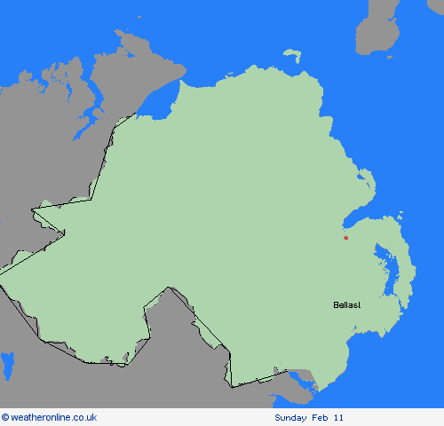
Weather Warnings Archive: Wednesday 07 Feb 2024 12:00 GMT - UK


Severe Weather Warnings: Snow/Ice
issued by the Metoffice at
12:00, 07.02.2024
valid from
10:00, 08.02.2024
until
06:00, 09.02.2024
Region: Northern Ireland
An area of rain, sleet and snow will push north out of the Republic of Ireland and into Northern Ireland late morning. Some heavier bursts are likely at times, though with most of the accumulating snow likely over higher ground. Some low-lying areas away from immediate coasts could see 1-3 cm, whilst higher routes, such as the Glenshane Pass, could see 4-8 cm of snow. Strong and gusty easterly winds may lead to some drifting in places, mainly over higher ground. Rain, sleet and snow will ease later Thursday and into Friday, but a few icy patches are likely, especially on untreated surfaces, or where treatment has been washed off. What should I do? Snowy, wintry weather can cause delays and make driving conditions dangerous. Keep yourself and others safe by planning your route, giving yourself extra time for your journey. Check for road closures or delays to public transport and amend plans if necessary. If driving, make sure you have some essentials in your car in the event of any delays (e.g., warm clothing, food, water, a blanket, a torch, ice scraper/de-icer, a warning triangle, high visibility vest and an in-car phone charger). Be prepared for weather warnings to change quickly: when a weather warning is issued, the Met Office recommends staying up to date with the weather forecast in your area
Chief ForecasterA band of rain, sleet and snow will bring some travel disruption for parts of Northern Ireland through Thursday and into Friday
The public is advised to take extra care, further information and advice can be found here: http://www.metoffice.gov.uk/weather/uk/links.html
07.02.2024


