|
 Thursday Thursday
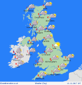
A squally band of rain clearing the southeast and East Anglia early on Thursday morning. Much brighter weather follows from the north and west, although feeling colder. Snow showers across Scotland, northwest England and the north and west of Ireland, these driven in by a gale to severe gale force northwest wind. Feeling bitter in the wind in the afternoonwith more snow showers to the north and west and the threat of accumulations in Scotland. Staying brighter east and south but remaining very cold and windy. Highs at 2 to 7C.
 Thursday Night Thursday Night
Staying windy overnight with a significant wind chill. There will be heavy snow showers in many northern and western areas, with some places waking to a covering of snow by the morning. Eastern and southern parts of England should be mostly dry, although there will be some wintry showers affecting eastern coasts as well as southwestern hills and coasts of England. Lows at -3 to 1C.
 Friday Friday
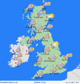
Low pressure to the east with higher pressure to the west on Friday. The northwest flow brings very cold conditions again with snow showers around northern and western coasts and hills as well as through the far southwest of England. A few wintry showers around northern and eastern coasts and hills too. Elsewhere dry and bright with good spells of sunshine but feeling bitterly cold in the wind. Highs at 0 to 3C.
 Saturday Saturday
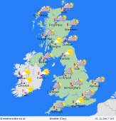
Northwesterly winds are likely to continue, bringing frequent snow to eastern coastal districts, plus northern Scotland. A few bands of showers may also affect some Irish sea coasts, perhaps running into north Wales and the northwest Midlands. Pressure is likely to build toward the west as the day progresses. Feeling bitterly cold in the wind. Frosty where sheltered. Highs 1 to 4C.
|


