|
Issued: 0530hrs Saturday 28th October 2017
Duty forecaster: Garry Nicholson
 Blustery, strongest winds in north Blustery, strongest winds in north
Good morning,
A brisk west to north-westerly wind influences the British Isles today. High pressure is centred to the south-west around Biscay, whilst low pressure is over Scandinavia.
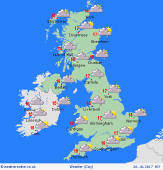
Fronts will trail eastwards across central-northern Britain, producing cloudy skies and drizzly rain, mainly in the west. Over the hills of north-west England and south-west Scotland it may be wet for many hours, but total rainfall small.
Central, southern & eastern England should stay dry and bright, with some sunshine in the morning, although cloud will tend to thicken from the west.
Blustery winds for all, which will be gale force over the hills and mountains, and there may be strong gusts locally to the east of the Pennines and Scottish Highlands.
Today's top temperatures will reach 14 to 17C, warmest toward the east & south, but where it stays damp it will be nearer 12C. Turning chilly tonight in the north as skies clear, with a frost possible in Scotland by dawn on Sunday.
Have a great day.
Garry
|
